Showing 19–22 of 22 results
-

₦4,000,000.00 VAT
The Hi-Target V600L Laser RTK System is a powerful next-generation GNSS receiver that combines advanced laser measurement, dual-camera imaging, high-performance IMU, and full-constellation tracking for precise, fast, and contactless surveying. Engineered for GNSS-challenged environments, the V600L delivers up to 2 cm laser accuracy, visual stakeout, non-contact measurement, and industry-leading 15–20 km LoRa communication for seamless fieldwork. Lightweight, IP68 rugged, and built for extreme conditions, it’s the ideal RTK system for surveyors working around obstacles, under bridges, near fences, or in semi-enclosed terrains.
-

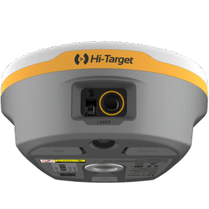
₦8,500,000.00 VAT
The Hi-Target V700S SLAM RTK System is a next-generation, multi-sensor GNSS receiver built for high-precision 3D mapping, laser scanning, and real-time positioning in challenging environments. With 1408-channel full-constellation tracking, laser reverse positioning, and RTK + SLAM fusion, it delivers uninterrupted centimeter-level accuracy even under bridges, tunnels, and GNSS-denied areas. Compact, rugged, and equipped with advanced Android processing, the V700S enables fast scanning, contactless measurement, and seamless field-to-office workflows for surveyors, engineers, and geospatial professionals.
-

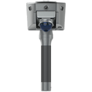
The AT-45101CP GNSS Choke Ring Antenna is a high-precision, full-band GNSS antenna engineered for CORS stations, deformation monitoring, geodetic surveying, and long-term structural monitoring. With exceptional multipath suppression, sub-millimeter phase center stability, and support for all major GNSS constellations—including L-Band—it delivers unmatched accuracy, reliability, and performance in demanding environments.
-
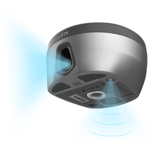

₦4,000,000.00 VAT
The Hi-Target vRTK Visual Positioning GNSS Receiver is a next-generation, pocket-sized RTK system built with dual cameras, high-performance image surveying, advanced IMU tilt compensation, and a powerful GNSS engine for fast, ultra-precise positioning. Designed for engineering, construction, mapping, and land surveying, it delivers 2–4 cm non-contact image measurements, AR live-view stakeout, full-constellation tracking, and seamless integration with 3D modeling software.