
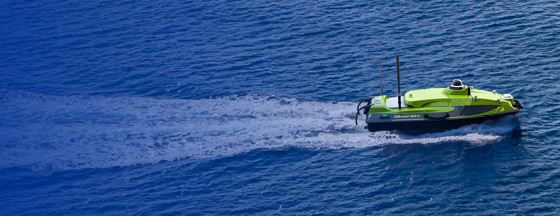
iBoat BS12 USV
₦25,000,000.00 VAT
The iBoat BS12 Android-Powered Multi-Function USV is a high-performance autonomous survey vessel engineered for bathymetry, ADCP current profiling, side-scan imaging, water quality monitoring, and hydrographic mapping. Featuring a carbon fiber/Kevlar hull, millimeter-wave radar, GNSS+IMU sub-meter navigation, 360° camera, dual-channel control (2.4G & 4G), and powerful onboard processing, it delivers unmatched stability, efficiency, and accuracy for marine and inland water survey missions.
Description
The iBoat BS12 Multi-Function USV is a next-generation autonomous surface vessel designed to redefine efficiency, precision, and reliability in hydrographic surveying and environmental monitoring. Powered by an advanced Android control system, the BS12 combines cutting-edge engineering with intelligent navigation features, making it ideal for bathymetric mapping, current profiling, water quality assessment, structure inspection, and scientific research.
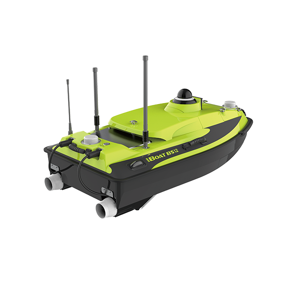
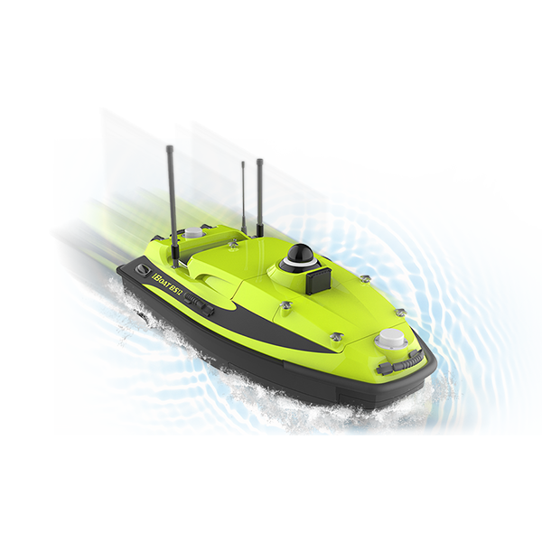
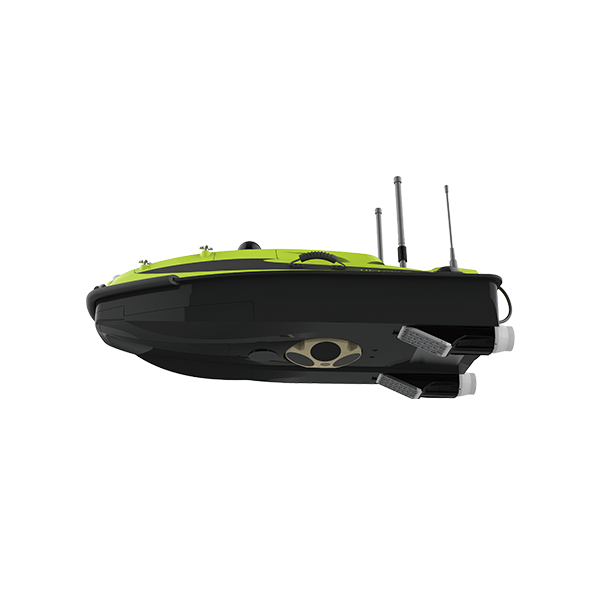
Crafted with a sleek carbon fiber and Kevlar hull, the BS12 offers exceptional durability, corrosion resistance, and lightweight maneuverability. This robust structure ensures long-term use in both freshwater and coastal environments while maintaining excellent stability in the face of waves and wind. Engineered using modern CFD technology, the hull minimizes drag, enhances balance, and supports mission execution even in challenging water conditions.
The BS12 integrates a millimeter-wave radar, 360° omnidirectional camera, and sub-meter GNSS+IMU navigation, enabling precise obstacle detection, real-time situational awareness, and improved positioning even when satellite signals are weak. Its intelligent IMU module compensates for motion and provides accurate heading information, ensuring dependable navigation during complex missions.
Equipped to support a wide range of scientific instruments—including ADCP, dual-frequency echo sounders, side-scan sonar, water quality sensors, and water samplers—the iBoat BS12 delivers unmatched versatility for hydrographic, environmental, and industrial applications. Both GNSS and bathymetry data streams can be integrated to enhance ADCP and SSS performance, producing more accurate and reliable measurement results.
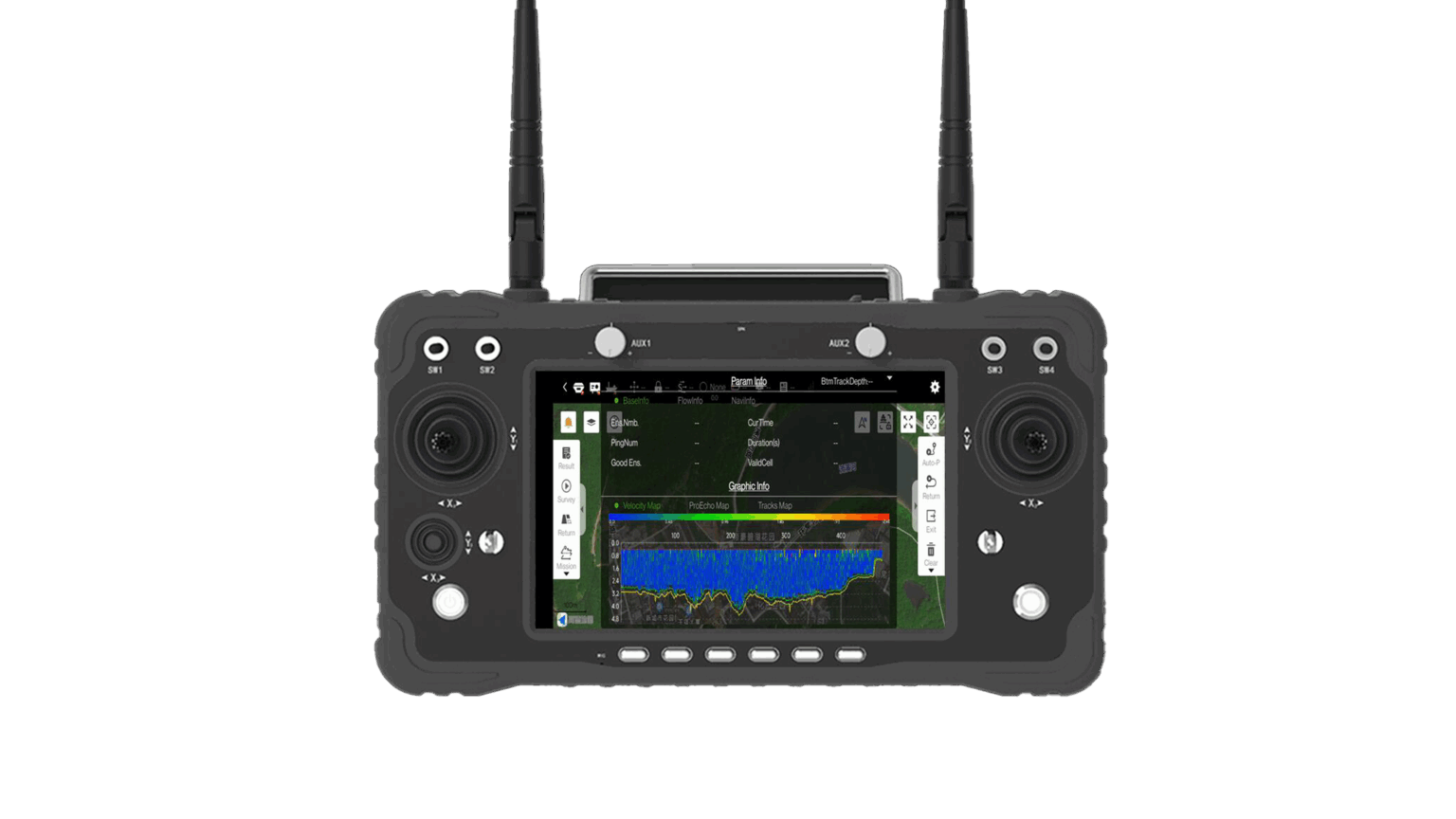
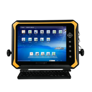
The advanced boat control system offers trajectory tracking, adaptive hover, mission planning, automated routing, and real-time vessel monitoring, all powered through the Hi-Survey Boat Android app or long-range 4G connectivity. Operators can control the vessel up to 1.3km via 2.4GHz or enjoy unlimited range through 4G, ensuring seamless operations across lakes, rivers, reservoirs, and near-shore environments.
With a top speed of 6 m/s and dual brushless propellers, the BS12 delivers powerful thrust, responsive steering, and efficient energy consumption. Its high-capacity battery supports long-duration missions, offering up to 4.5 hours per battery (two-battery configuration available). Safety features include collision warnings, shallow water alerts, and radar-based obstacle detection, ensuring secure autonomous operations.
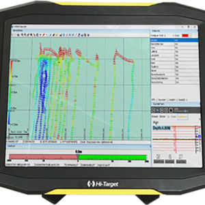
The BS12 integrates perfectly with HiMAX (Windows) for bathymetric post-processing, correction, and data exporting, making it an end-to-end solution for professional hydrographic workflows.
For hydrology teams, marine surveyors, environmental agencies, construction engineers, and scientific researchers, the iBoat BS12 USV offers the reliability, intelligence, and flexibility needed to achieve high-precision results in every aquatic survey mission.
Additional information
| Weight | 25 kg |
|---|---|
| General | Model: iBoat BS12 Product Type: Android-Powered Multi-Function USV Applications: Bathymetry, ADCP current profiling, side-scan sonar imaging, water sampling, water quality analysis, environmental monitoring, hydrographic survey Hull Material: Carbon fiber (optional Kevlar), rubber bumper |
| Dimensions & Weight | Hull Dimensions (L × W × H): 1185 × 593 × 397 mm Weight (No Battery): 25 kg Max Load Capacity: 25 kg |
| Performance | Maximum Speed: 6 m/s Anti-Wave Capability: 2nd Wave Level Anti-Wind Capability: 3rd Wind Level IP Rating: IP67 Propulsion: Dual brushless propellers Direction Control: Veering (no rudder required) |
| Navigation & Sensors | Satellite Systems: GPS, BDS, GLONASS, Galileo RTK Positioning Accuracy: Horizontal: ±8mm + 1 ppm RMS Vertical: ±15mm + 1 ppm RMS INS Heading Accuracy: 0.2° @ 1 m baseline INS Drift: 2.1°/h, <1 m/20s IMU: Integrated (motion compensation enabled) Refresh Rate: 200 Hz Collision Detection: Millimeter-wave radar (10–30 m detection) Camera: 360° omnidirectional video |
| Communications & Control | Control Range: 1.3 km on 2.4 GHz Unlimited range on 4G Connectivity: 2.4G, 4G, WLAN Control Software: Hi-Survey Boat (Android) Mission Management: HiMAX (Windows) for bathymetry processing |
| Echo Sounder (SBES) | Frequency: 200kHz (single), 200kHz + 24kHz dual frequency optional Depth Range: 0.2–200 m (200kHz), 0.8–600 m (24kHz) Accuracy: ±1 cm + 0.1%h (200 kHz), ±10 cm + 0.1%h (24 kHz) Resolution: 1 cm (200kHz), 10 cm (24kHz) Beam Angle: 6.9° ± 2° (200kHz), 34.1° ± 3° (24kHz) |
| Expandable Sensors / Payloads | Acoustic Doppler Current Profiler (ADCP) Side-scan sonar (SSS) Single beam echo sounder (SBES) Dual-frequency echo sounder (optional) Water sampler Multi-parameter water quality meter |
| Power | Battery Endurance: 4.5 hours at 1.5 m/s (single battery) Dual battery support available |
| Additional Features | Trajectory tracking Adaptive flow hovering Collision & shallow water warnings Real-time position & data backup Track import and plotting Full Android interface control |
Only logged in customers who have purchased this product may leave a review.

Reviews
There are no reviews yet.