


vRTK GNSS RTK System
₦4,000,000.00 VAT
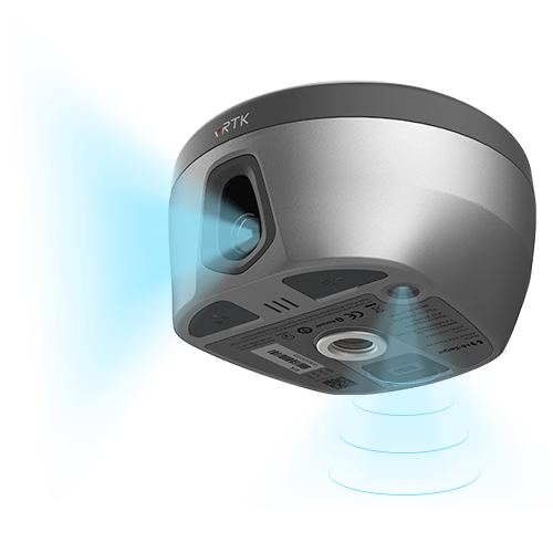
The Hi-Target vRTK Visual Positioning GNSS Receiver is a next-generation, pocket-sized RTK system built with dual cameras, high-performance image surveying, advanced IMU tilt compensation, and a powerful GNSS engine for fast, ultra-precise positioning. Designed for engineering, construction, mapping, and land surveying, it delivers 2–4 cm non-contact image measurements, AR live-view stakeout, full-constellation tracking, and seamless integration with 3D modeling software.
Description
The Hi-Target vRTK Visual Positioning GNSS Receiver is a revolutionary lightweight RTK solution engineered for modern surveyors who demand speed, accuracy, and unmatched flexibility. Equipped with advanced visual positioning technology and dual high-resolution cameras, the vRTK enables non-contact image surveying within 2–15 meters, delivering 2–4 cm accuracy—even in areas where traditional GNSS methods struggle.
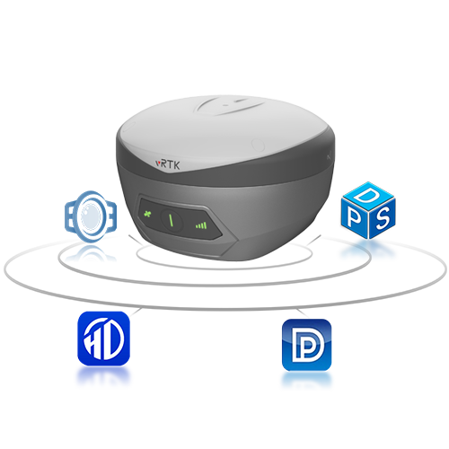
Powered by a new-generation multi-constellation GNSS engine supporting GPS, GLONASS, Galileo, BDS, QZSS, IRNSS, and SBAS, the vRTK ensures fast fixing, superior signal quality, and stable data capture in challenging environments. The AR live-view stakeout feature provides real-time, camera-guided stakeout with 2 cm accuracy, making workflows faster, safer, and more efficient.

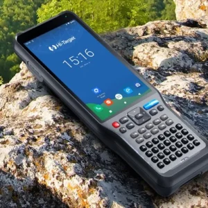
The upgraded IMU delivers seamless tilt compensation with auto-installation, ensuring high-precision measurements without leveling the pole. The receiver integrates effortlessly with Hi-Survey software and the iHand55 handheld controller, enabling powerful field workflows, advanced engineering functions, 3D modeling support, and streamlined data transfer.
The vRTK is ideal for engineers, surveyors, construction professionals, GIS teams, and mapping specialists seeking a compact, high-performance RTK system that merges traditional GNSS power with cutting-edge visual technology. It supports multiple data formats, third-party processing tools, and mainstream modeling software, making it a future-proof solution for high-demand field applications.
Additional information
| GNSS Positioning Accuracy | RTK Horizontal Accuracy: 10 mm + 1 ppm (RMS) RTK Vertical Accuracy: 20 mm + 1 ppm (RMS) Image Positioning Accuracy: 2 cm AR Live-View Stakeout Accuracy: 2 cm Image Survey Accuracy Range: 2–4 cm Tilt Survey Accuracy: 8 mm + 0.7 mm/° tilt Hi-Fix Positioning: Horizontal: 10 cm Vertical: 20 cm Note: Ends after 5 minutes without differential data |
|---|---|
| Supported Satellite Constellations | BDS (BeiDou) GPS GLONASS GALILEO QZSS IRNSS (NavIC) SBAS |
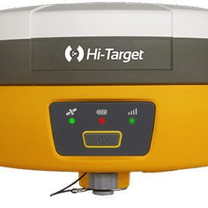
| Physical Specifications | Dimensions: Φ130 mm × 79 mm Weight: ≤ 0.97 kg |
| Storage | Internal Storage: Built-in 8 GB ROM |
Only logged in customers who have purchased this product may leave a review.


Reviews
There are no reviews yet.